OCE 1001 Final Exam
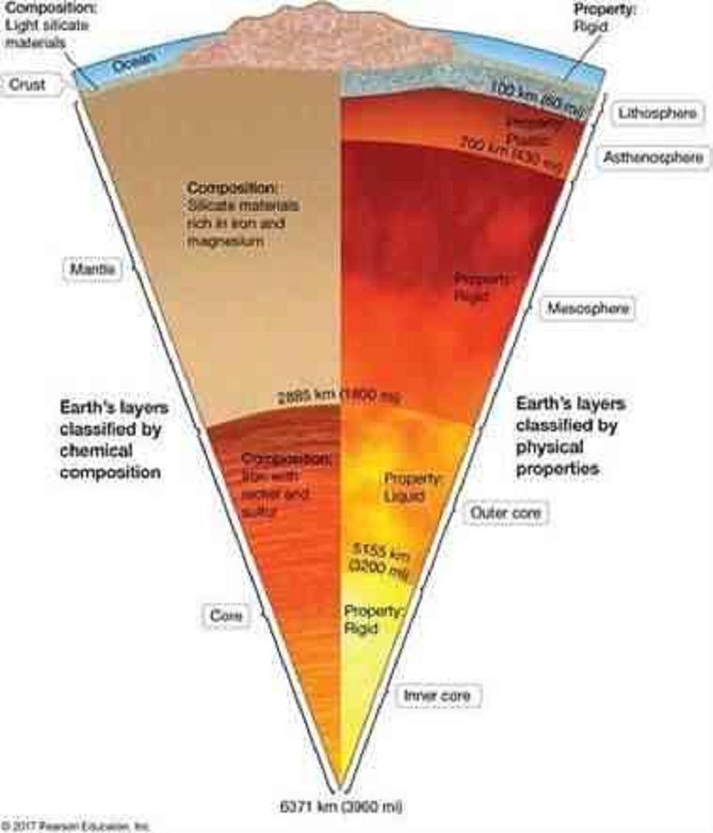
Which of the following is Earth's rigid layer that includes the crust plus the topmost portion of the mantle?
Asthenosphere
Inner core
Lithosphere
Mesosphere
Outer core

Which of the following is Earth's liquid iron-nickel layer?
Asthenosphere
Inner core
Lithosphere
Mesosphere
Outer core
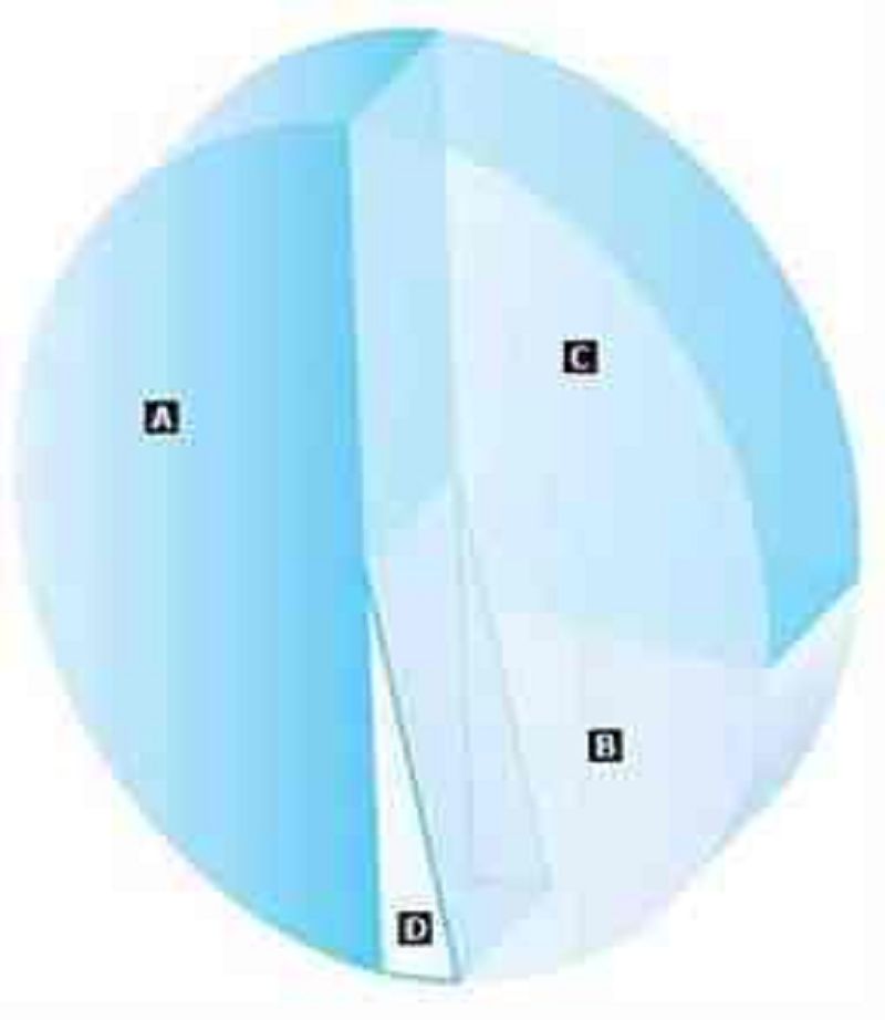
On the pie diagram below, match the name of the ocean with its correct relative size.Match the words in the left column to the appropriate blanks in the sentences on the right. Make certain each sentence is complete before submitting your answer.
D: Arctic Ocean
B: Indian Ocean
A: Pacific Ocean
C: Atlantic Ocean
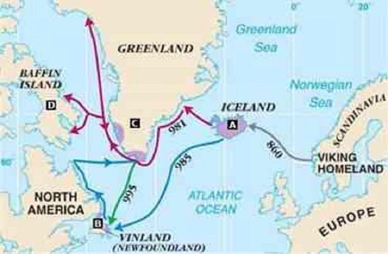
This map depicts the voyages of the Vikings. Match the correct letter with the statements below.Match the words in the left column to the appropriate blanks in the sentences on the right. Make certain each sentence is complete before submitting your answer.
B: This is the land discovered by Leif Eriksson.
C: When Eric the Red was banished from Iceland, he discovered this land, where he later started a colony.
A: This was the first new land conquered by the Vikings.
D: It is believed that Eric the Red may have discovered this area.
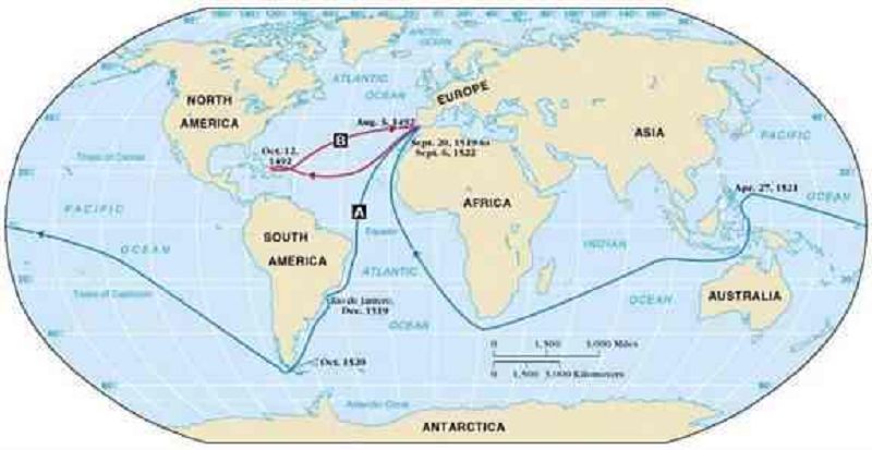
This map depicts the voyages of some European explorers during the Age of Discovery. Match the route with each explorer.Match the words in the left column to the appropriate blanks in the sentences on the right. Make certain each sentence is complete before submitting your answer.
B: Columbus
A: Magellan
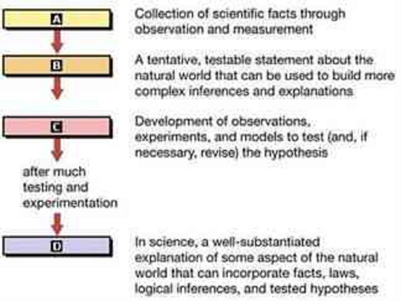
Match the steps of the scientific method with the chart below.Match the words in the left column to the appropriate blanks in the sentences on the right. Make certain each sentence is complete before submitting your answer.
C: Testing
A: Observation
D: Theory
B: Hypothesis
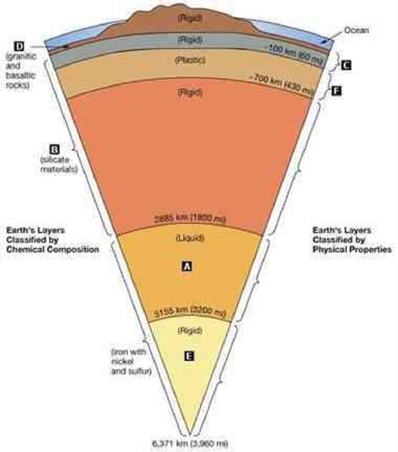
In the cross-sectional view of Earth's interior shown below, correctly match each layer with its appropriate name. Match the words in the left column to the appropriate blanks in the sentences on the right. Make certain each sentence is complete before submitting your answer.
A: Outer Core
D: Crust
C: Lithosphere
E: Inner core
B: Mantle
F: Asthenosphere
Match the term with the appropriate phrase. Drag the terms on the left to the appropriate blanks on the right to complete the sentences. (Matching & Terms)
Panthalassia − ancient precursor of the Pacific Ocean
Pangaea − supercontinent 250 million years ago
Rift valley − depression along a ridge axis
Paleomagnetism − study of magnetism over geologic time
Subduction zone − sloping area from a trench along a downward moving plate
Match the term with the appropriate phrase. Drag the terms on the left to the appropriate blanks on the right. (Terms can be used more than once.) (Matching & Term)
Island arc − subduction zone
Mid-ocean ridge − spreading center
Seafloor magnetic stripes − spreading center
Seafloor spreading − spreading center
Trench − subduction zone
NOT USED: spreading center subduction zone
Review the accompanying topographic map of the eastern United States and the figure of a typical continental margin in this region. Label the different features shown. Note that not all labels will be used. Drag the appropriate labels to their respective targets. You do not need to use all labels. (Label the Picture)
From Top to Bottom: Continental Shelf, Shelf Break, Continental Slope, Continental Rise, Passive continental margin
NOT USED: Deep Ocean Trench, Active continental margin
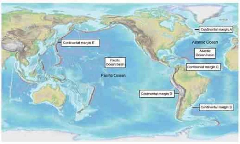
Label these features correctly for margin type and ocean basin dynamics.Drag the appropriate items to their respective bins.
Active Continental Margins: Continental margin D Continental margin E
Passive Continental Margins: Continental margin A Continental margin B Continental margin C
Shrinking Ocean Basin: Pacific Ocean Basin
Expanding Ocean Basin: Atlantic Ocean Basin
Match the words in the left column to the appropriate blanks in the sentences on the right. Make certain each sentence is complete before submitting your answer. Note that some terms will remain unused. (Match & terms)
Oceanic crust spreads at MID-OCEAN RIDGES, creating new crust and slowly enlarging the ocean basin.
SUBMARINE CANYONS are deep valleys at passive continental boundaries. They are likely carved out by TURBIDITY CURRENTS, which occur when sediment-laden water rapidly moves down slope.
Melt from the subducting plate rises to the surface, erupts through the crust on the overriding plate and forms CONTINENTAL VOLCANIC ARCS on continents, or VOLCANIC ISLAND ARCS in the ocean.
. Subduction zones surrounding the Pacific Ocean give rise to volcanoes. This area surrounding the Pacific Ocean is called the RING OF FIRE.
Match the term with the appropriate phrase. Drag the terms on the left to the appropriate blanks on the right.
HYPSOGRAPHIC CURVE− cumulative plot of the frequency of depth or elevation
SEISMAN REFLECTION PROFILE− used to determine ocean structure beneath the sea floor
MULTI-BEAN SONAR− a method of mapping the topography of the ocean floor along a strip up to 60 km wide
PRECISION-DEPTH RECORDER (PDR)− uses high frequency sound waves to measure ocean depth
BATHYMETRY− measurement of ocean depth and seafloor topography

Match the words in the left column to the appropriate blanks in the sentences on the right. Make certain each sentence is complete before submitting your answer.
B: Continental margin
A: Mid-ocean ridge
C: Ocean basin
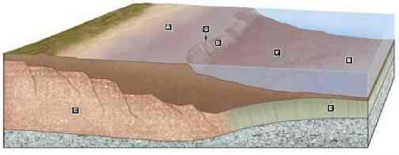
Match the words in the left column to the appropriate blanks in the sentences on the right. Make certain each sentence is complete before submitting your answer.
G: Shelf break
A: Continental shelf
C: Continental crust
D: Continental slope
B: Abyssal plain
E: Oceanic crust
F: Continental rise
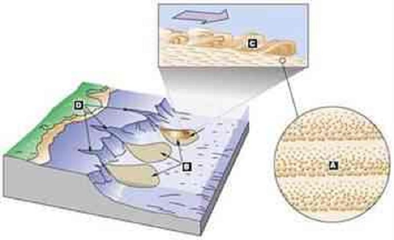
Match the words in the left column to the appropriate blanks in the sentences on the right. Make certain each sentence is complete before submitting your answer.
C: Turbidity current
B: Deep-sea fans
A: Graded bedding
D: Submarine canyons
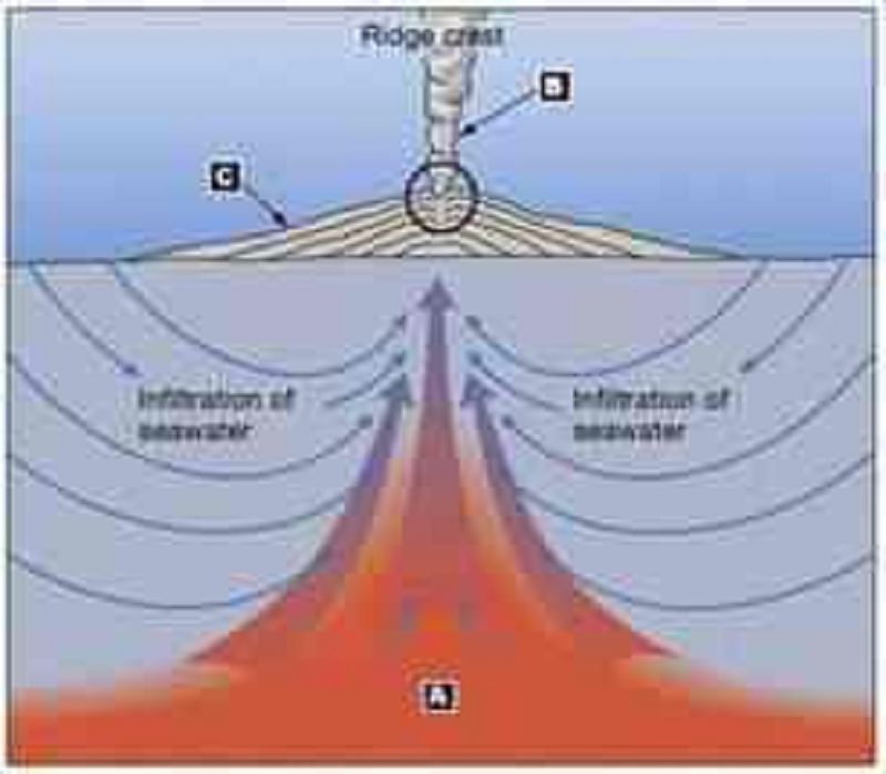
Match the words in the left column to the appropriate blanks in the sentences on the right. Make certain each sentence is complete before submitting your answer.
C: Metal sulfide deposits
A: Magma (heat source)
B: Black smoker
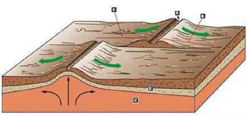
Match the words in the left column to the appropriate blanks in the sentences on the right. Make certain each sentence is complete before submitting your answer.
A: Rift valley of a mid-ocean ridge
D: Transform fault
C: Asthenosphere
B: Fracture zone
E: Lithosphere
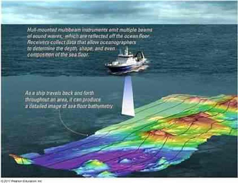
Which of the following techniques used to determine ocean bathymetry is illustrated in the image?
Magnetometer
Multibeam Sonar
Seismic Reflection
Side-scan Sonar
Sounding
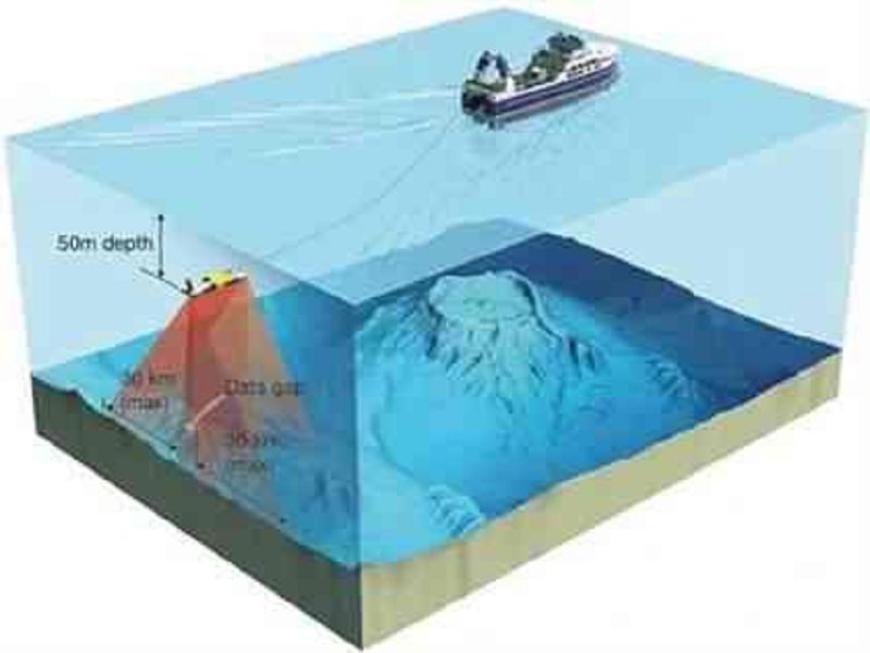
Which of the following techniques used to determine ocean bathymetry is illustrated in the image?
Magnetometer
Multibeam Sonar
Seismic Reflection
Side-scan Sonar
Sounding
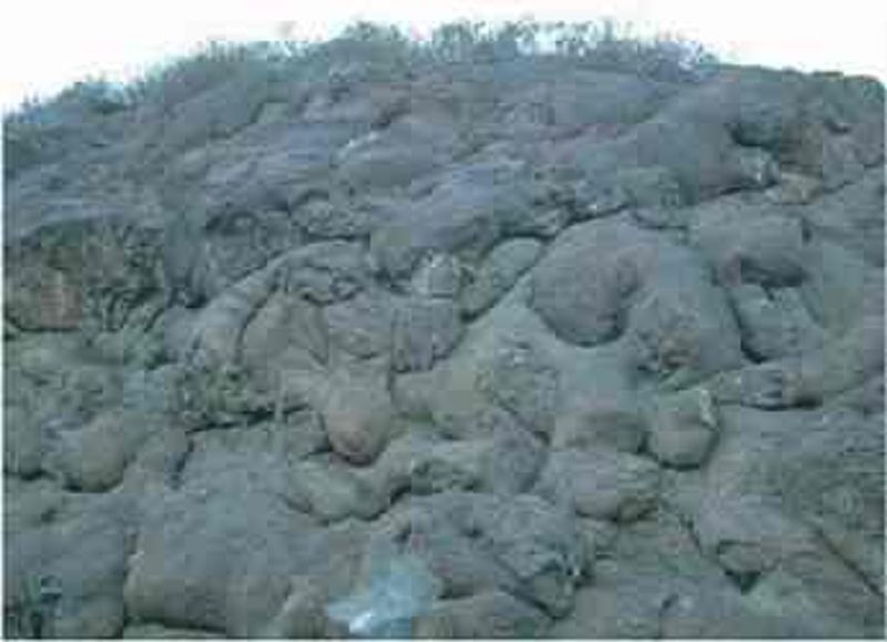
Rocks like the ones shown in the photo most likely formed at which of the following tectonic settings?
Convergent plate boundary
Divergent plate boundary
Intraplate setting
Transform plate boundary
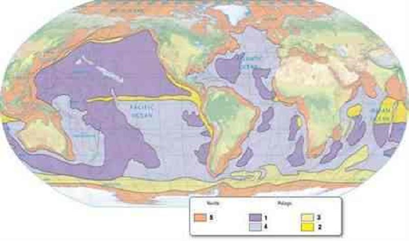
The sediments that are produced in areas of high primary productivity are indicated by the number(s):
2 & 3
2
1
3 & 4
3
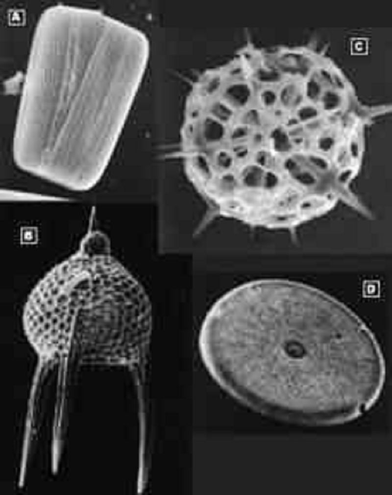
Match the words in the left column to the appropriate blanks in the sentences on the right. Make certain each sentence is complete before submitting your answer.
D: Diatom, top view
C: Radiolarian, spherical shape
A: Diatom, showing both halves of its test
B: Radiolarian, showing long appendages
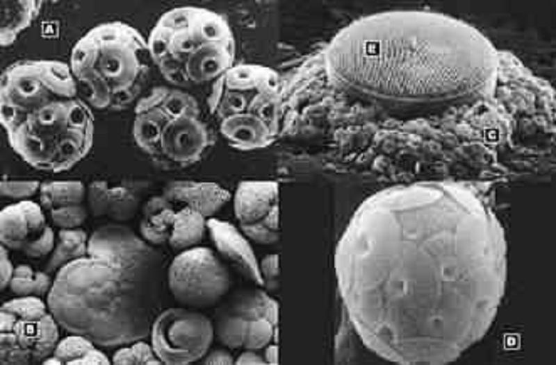
Match the words in the left column to the appropriate blanks in the sentences on the right. Make certain each sentence is complete before submitting your answer.
B: Foraminifers
A: Coccolithophores (multiple)
D: Coccolithophore (single)
C: Coccoliths (individual plates)
E: Diatom (siliceous)
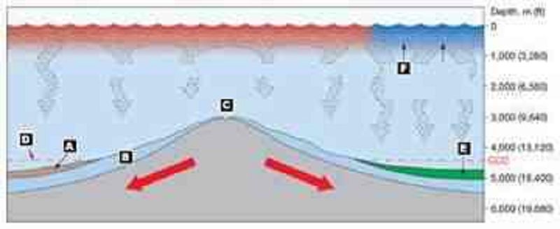
Match the words in the left column to the appropriate blanks in the sentences on the right. Make certain each sentence is complete before submitting your answer.
D: Calcite compensation depth (CCD)
A: Abyssal clay
E: Siliceous ooze
C: Mid-ocean ridge
F: Upwelling, cool water
B: Calcareous ooze
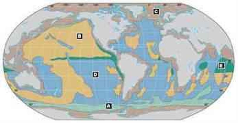
Match the words in the left column to the appropriate blanks in the sentences on the right. Make certain each sentence is complete before submitting your answer.
D: Calcareous ooze
E: Siliceous ooze: radiolarian
B: Abyssal clay
A: Siliceous ooze: diatom
C: Neritic continental lithogenous
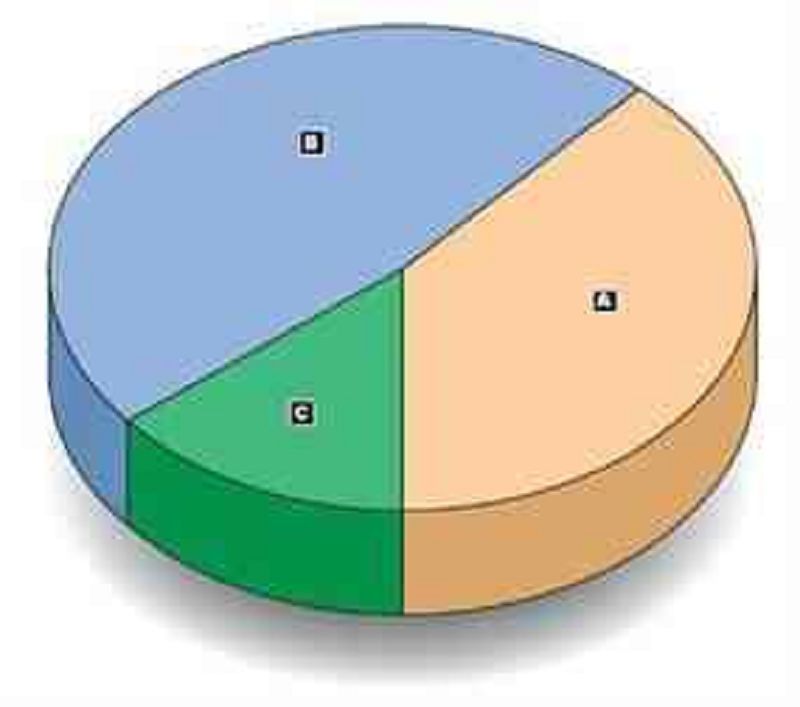
Match the words in the left column to the appropriate blanks in the sentences on the right. Make certain each sentence is complete before submitting your answer.
C: Siliceous ooze
A: Abyssal clay
B: Calcareous ooze
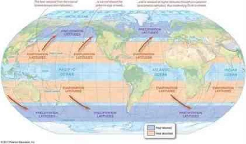
Which of the following surface seawater salinity conditions would you predict for the following location: Latitude: 20°N Longitude: 180°W
High surface seawater salinity due to evaporation
High surface seawater salinity due to precipitation
Low surface seawater salinity due to evaporation
Low surface seawater salinity due to evaporation
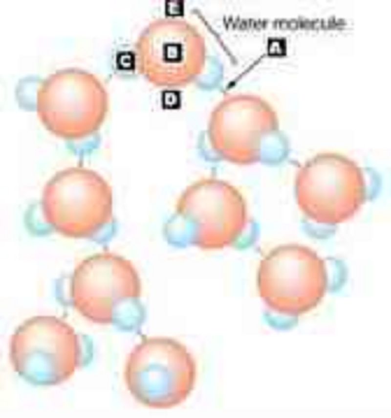
Match the words in the left column to the appropriate blanks in the sentences on the right. Make certain each sentence is complete before submitting your answer.
B: Oxygen atom
C: Hydrogen atom
A: Hydrogen bond
E: Negatively charged side of the water molecule
DPositively charged side of the water molecule
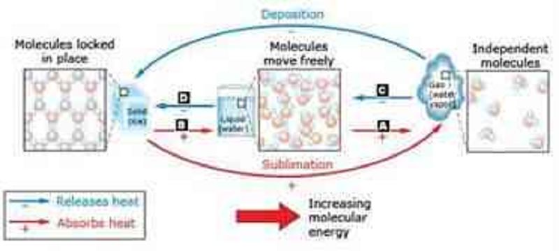
Match the words in the left column to the appropriate blanks in the sentences on the right. Make certain each sentence is complete before submitting your answer.
A: Vaporization (evaporation/boiling)
B: Melting
D: Freezing
C: Condensation
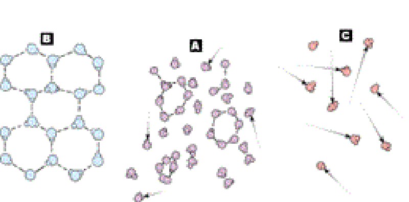
Match the words in the left column to the appropriate blanks in the sentences on the right. Make certain each sentence is complete before submitting your answer.
A: Liquid
C: Gas
B: Solid
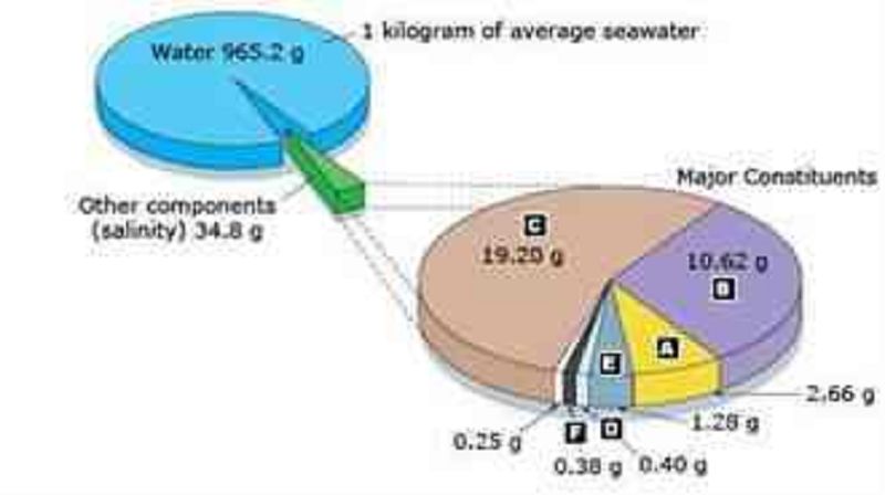
Match the words in the left column to the appropriate blanks in the sentences on the right. Make certain each sentence is complete before submitting your answer.
E: Magnesium
C: Chloride
F: Potassium
B: Sodium
D: Calcium
A: Sulfate
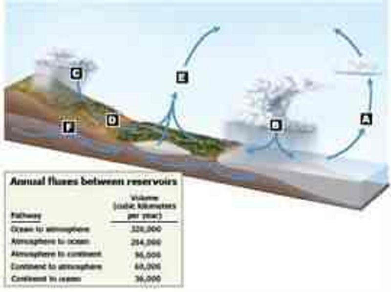
Match the words in the left column to the appropriate blanks in the sentences on the right. Make certain each sentence is complete before submitting your answer.
E: Smaller amount of evaporation, including transpiration (worldwide)
A: Greatest amount of evaporation (worldwide)
B: Greatest amount of precipitation (worldwide)
C: Smaller amount of precipitation (worldwide)
D: Runoff
F: Infiltration
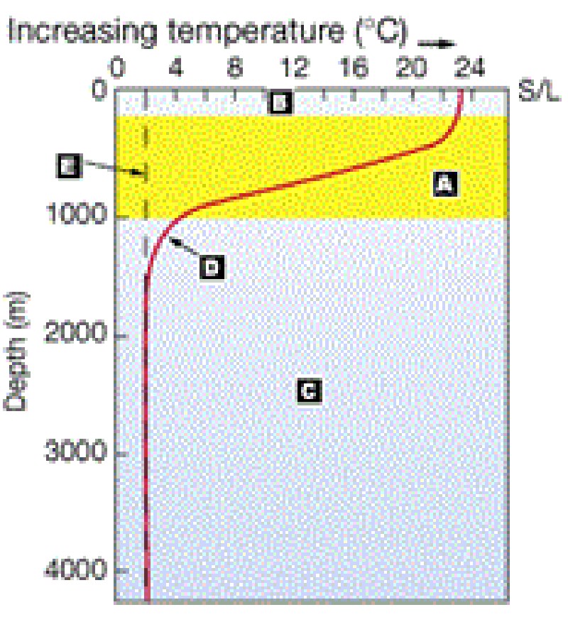
Match the words in the left column to the appropriate blanks in the sentences on the right. Make certain each sentence is complete before submitting your answer.
E: Curve for high latitudes
A: Thermocline
C: Layer with the highest density
D: Curve for low latitudes
B: Mixed layer
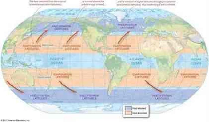
Which of the following surface seawater salinity conditions would you predict for the following location: Latitude: 20°N Longitude: 180°W
High surface seawater salinity due to evaporation
High surface seawater salinity due to precipitation
Low surface seawater salinity due to evaporation
Low surface seawater salinity due to precipitation
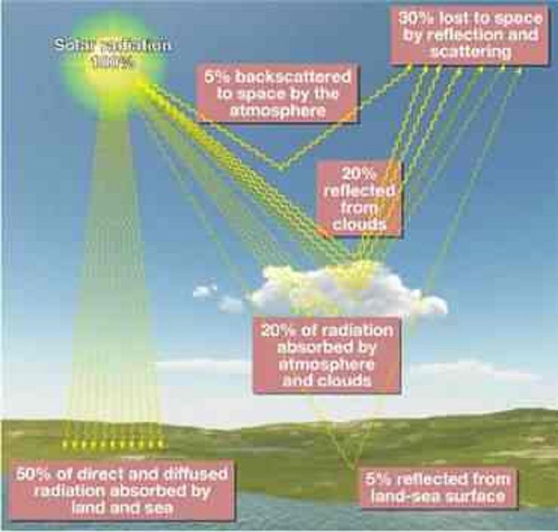
The image below shows that about 30 percent of the Sun’s energy is reflected and scattered back into space. How would a 50 percent increase in Earth’s albedo impact average surface temperatures?
Surface temperatures would increase, causing a decrease in surface water and/or ice on Earth, and would thus cause a further increase in albedo.
A higher albedo means more of the Sun's radiation is absorbed by Earth's surface.
Ice sheets would advance, thereby increasing Earth's overall albedo and further cooling Earth's surface.
Higher albedo would result in cooler temperatures on Earth.
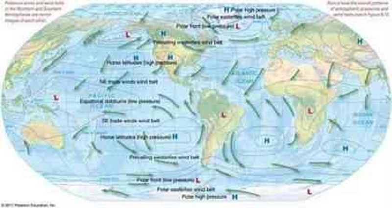
The atmospheric high-pressure cells over North America in the map suggest that the atmospheric patterns shown most likely represent which season for the northern hemisphere?
Spring
Winter
Fall
Summer
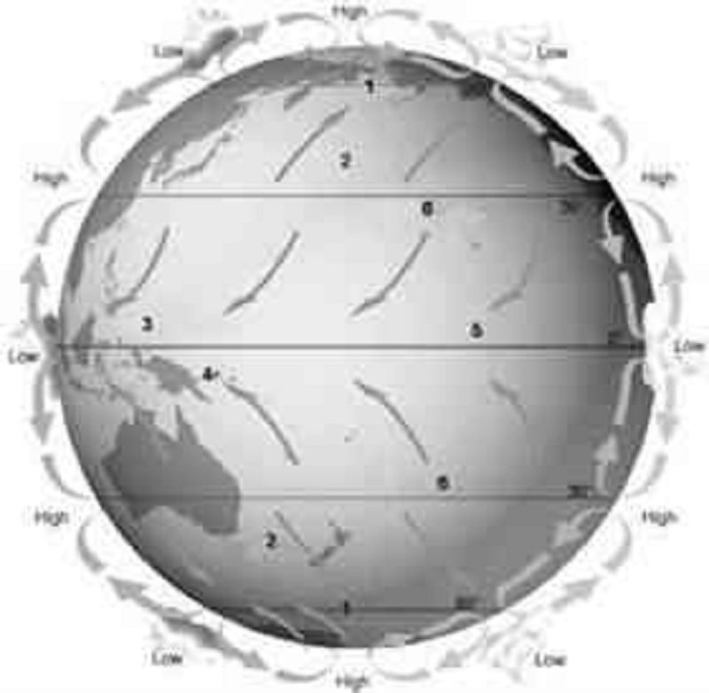
Variable winds that result in generally clear, dry, and fair conditions with minimal precipitation are labeled number:
1
2
3
4
5
6
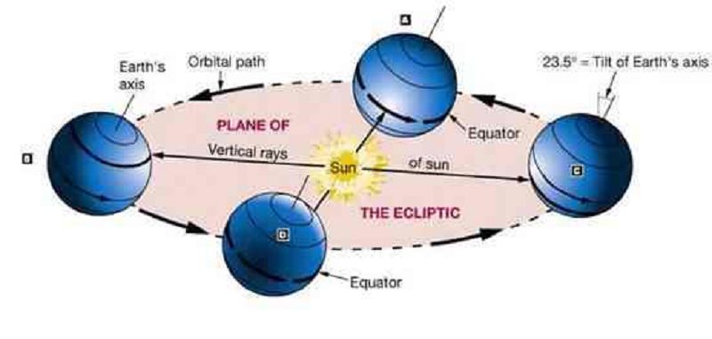
Match the words in the left column to the appropriate blanks in the sentences on the right. Make certain each sentence is complete before submitting your answer.
C: Winter solstice
A: Vernal equinox
B: Summer solstice
D: Autumnal equinox
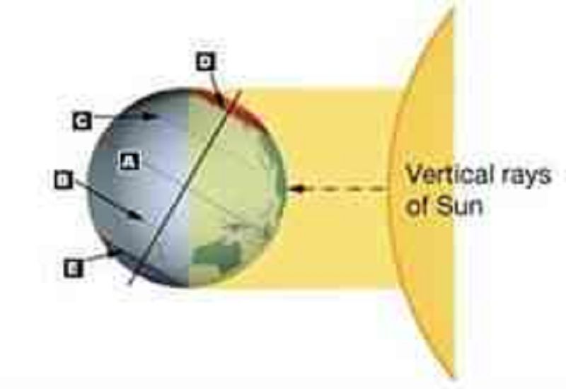
Match the words in the left column to the appropriate blanks in the sentences on the right. Make certain each sentence is complete before submitting your answer.
C: tropic of cancer
B: Tropic of Capricorn
A: Equator
D: Arctic Circle
E: Antarctic Circle
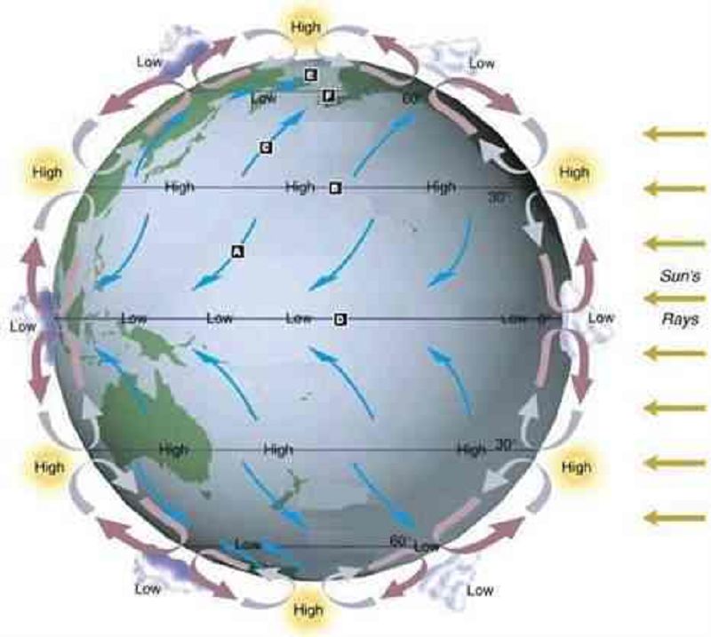
Match the words in the left column to the appropriate blanks in the sentences on the right. Make certain each sentence is complete before submitting your answer.
B: Boundary: horse latitudes
F: Boundary: polar front
A: Wind belt: trade winds
E: Wind belt: polar easterlies
D: Boundary: doldrums
C: Wind belt: prevailing westerlies
{"name":"OCE 1001 Final Exam", "url":"https://www.quiz-maker.com/QPREVIEW","txt":"Which of the following is Earth's rigid layer that includes the crust plus the topmost portion of the mantle?, Which of the following is Earth's liquid iron-nickel layer?, On the pie diagram below, match the name of the ocean with its correct relative size.Match the words in the left column to the appropriate blanks in the sentences on the right. Make certain each sentence is complete before submitting your answer.","img":"https://cdn.poll-maker.com/24-916897/1-4-1to9.jpg?sz=1200"}
More Quizzes
Party Etiquette
7422
What teacher are you most like?
740
Naturalism
6312
What sea animal are you?
4227
If I Were an Animal, What Would I Be?
201018787
Nervous System Anatomy & Physiology - Free Practice
201017673
Rick Riordan - How Well Do You Know His Books?
201023006
Twilight Character Test - Which One Are You?
201018024
What NFL Player Am I? - Find Your Football Twin
201016611
Warrior Cats Creator - Build Your Clan Cat
201016611
Gossip Girl: Are You Blair, Serena, or Chuck?
201018627
Piercing Types - Test Your Knowledge
201019554


